Browse sample poster results on the right, then tap one to load that prompt back into the generator on the left.
Build historical event maps with GPT Image 2 prompts
Turn routes, dates, regions, fronts, voyages, and civic turning points into a readable map-first visual that still leaves room for human fact-checking.
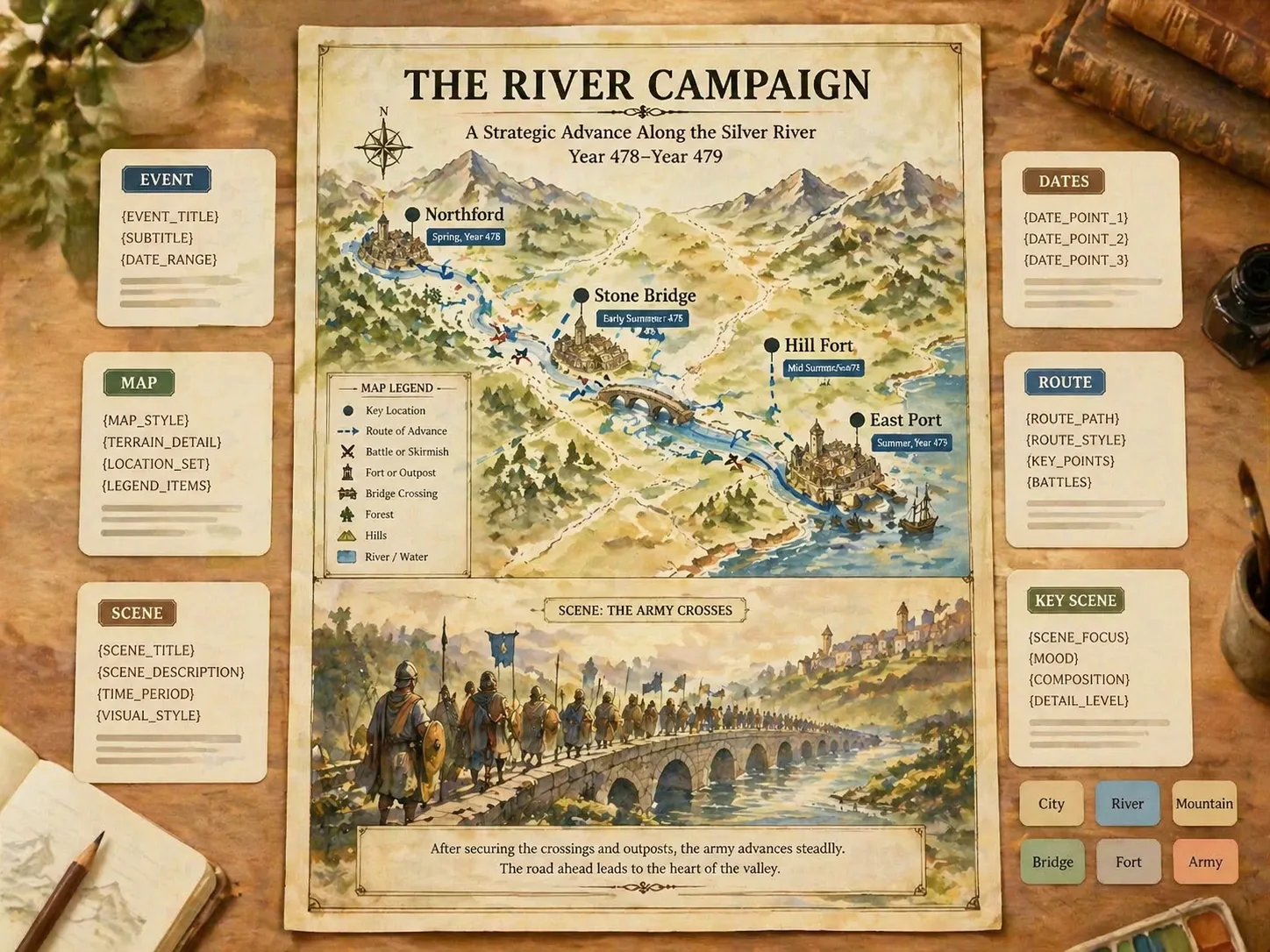
Map the event structure
Start from prompts built for campaigns, sieges, voyages, revolutions, independence movements, maritime conflicts, and front-line changes. Each template asks GPT Image 2 for labeled geography, directional arrows, date tags, and a compact legend instead of a generic history illustration.
Combine geography and scene
Use the two-part layout to place the map in the upper section and a respectful illustrated moment below it. That pairing helps viewers connect places, movement, and human context in one classroom-ready or editorial history explainer.
Edit facts before generating
Replace the event name, region, date range, city labels, route sequence, battle markers, ports, districts, or lower-panel moment before you generate. The output is a visual draft, so names, dates, routes, and claims should still be checked by a human.
Localize labels and lessons
The prompt set includes language-aware examples for English, Chinese, Korean, Japanese, Portuguese, Spanish, German, and French pages. Use them when you need visible titles, labels, legends, and short notes to match the audience reading the map.
From event notes to a map explainer
Choose the closest map prompt, replace the historical variables, then generate and refine the GPT Image 2 result.
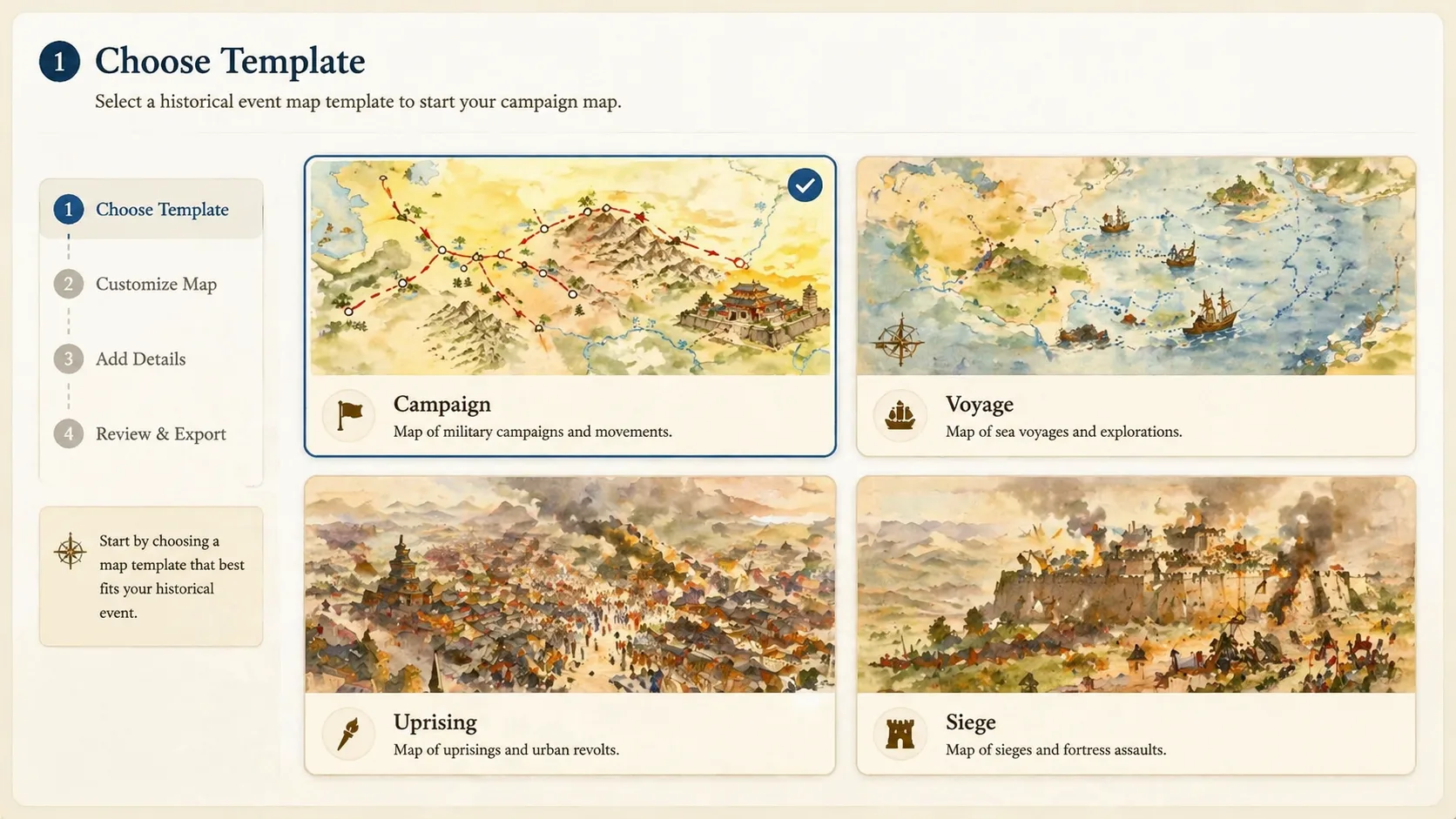
Choose the closest historical map prompt
Pick the template that matches the structure of the topic: a war campaign map for troop movement, an ancient route lesson for trade or migration, a maritime conflict for ports and sea lanes, or a revolution map for city districts and civic events.
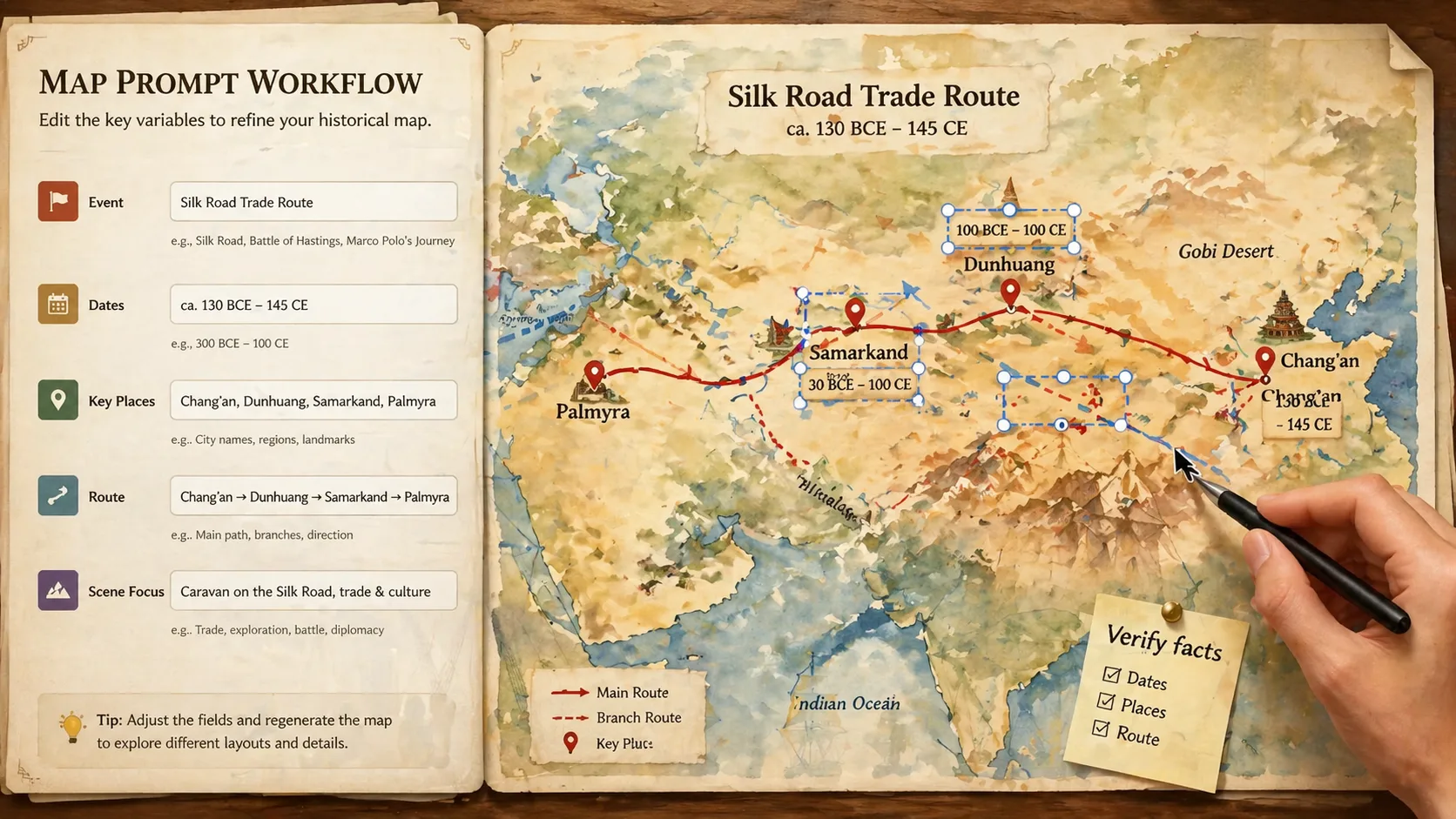
Replace routes, dates, and labels
Fill in the event title, period, region, route arrows, key places, phases, legend terms, and lower scene. Keep the prompt specific enough for GPT Image 2 to draw a useful map, but avoid unsupported claims or modern political slogans.
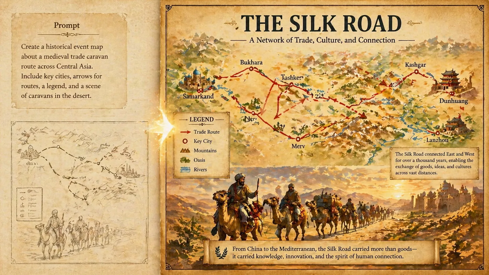
Generate, review, and refine
Create the first visual, inspect label readability and historical plausibility, then revise the prompt for cleaner arrows, shorter place names, safer symbols, or a better lower-panel moment before publishing or teaching with the image.
Historical event map GPT Image 2 prompt FAQ
Search-focused answers for creating historical map prompt templates and classroom explainers.
Generate a historical map
Start with a historical event map GPT Image 2 prompt, edit the facts, and create a map-plus-scene explainer you can review and refine.